Structured Survey and Digital Recording in Coastal Environments
The maritime environment surrounding Sapientza Island forms an integral part of the broader research landscape. While historical documentation and terrestrial analysis provide valuable insight, submerged contexts require specialised methodologies adapted to environmental and ethical conditions.
The Sapientza Maritime Landscape Project incorporates structured underwater documentation techniques designed to record, map, and interpret coastal and near-shore features without intrusive intervention.
Low-Impact Free-Diving Survey
Free-diving provides a controlled and minimally invasive approach to preliminary underwater reconnaissance in shallow coastal zones.
Within defined depth limits and under strict safety protocols, trained participants:
• Conduct visual inspection of seabed features
• Record spatial relationships and orientation
• Identify structural or artefactual anomalies
• Document environmental conditions
This approach avoids heavy equipment impact and allows careful observation of submerged surfaces.
All survey activity is conducted under appropriate supervision and in accordance with heritage protection frameworks.
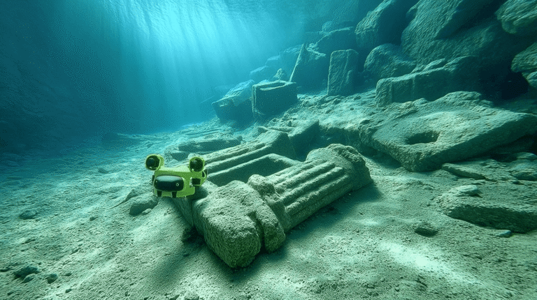
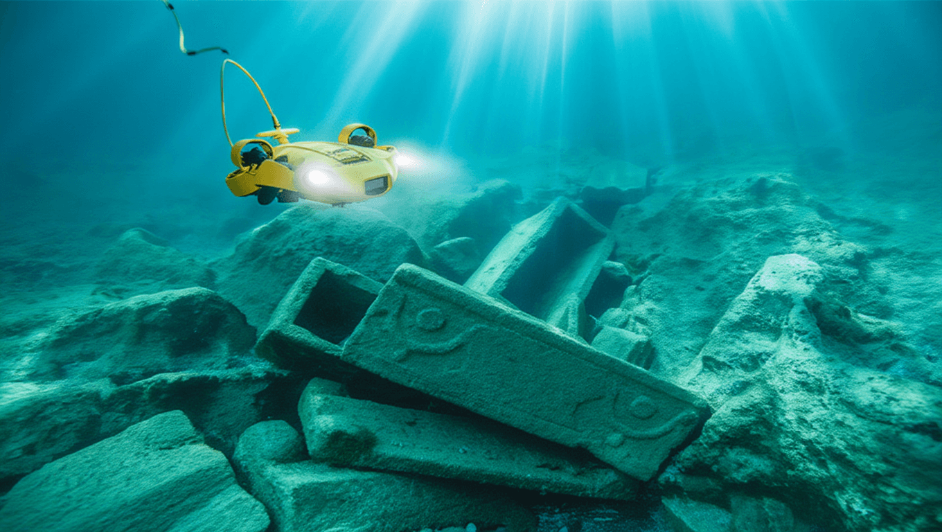
Underwater Drone Reconnaissance
To complement diver-based observation, remotely operated underwater drones are employed for:
• High-resolution video capture
• Stable imaging in variable visibility
• Extended reach beyond safe free-diving depths
• Controlled documentation of inaccessible areas
Drone footage provides continuous spatial records and allows later analytical review in controlled laboratory settings.
The integration of diver-based observation and drone reconnaissance strengthens both accuracy and safety.
Photogrammetry and Spatial Recording
Where conditions permit, overlapping photographic datasets are collected to support photogrammetric modelling.
Through structured image capture and calibrated positioning, submerged surfaces may be transformed into measurable digital models.
These models allow:
• Detailed examination of surface morphology
• Assessment of structural alignment
• Monitoring of environmental impact
• Long-term digital archiving
Digital recording extends the lifespan of observation beyond the immediate field season.
Safety and Ethical Framework
Underwater documentation operates within strict parameters.
The project adheres to:
• Established safety procedures
• Environmental protection standards
• Non-intrusive recording principles
• Respect for cultural heritage regulations
Exact coordinates of sensitive locations are not publicly disclosed.
The emphasis remains on documentation and interpretation, not extraction.
Integrating Surface and Submerged Data
Underwater datasets are combined with:
• Coastal topographic mapping
• LiDAR terrain modelling
• Archival research
• Terrestrial architectural documentation
This integrated approach allows analysis of how maritime activity relates to visible fortifications and coastal watchpoints.
Sapientza is therefore studied as a continuous environment — above and below the waterline.
Towards Digital Reconstruction
Documented underwater features contribute to the broader digital framework of the project.
Where appropriate, recorded data may support:
• Three-dimensional site modelling
• Interpretative reconstruction
• Educational visualisation tools
• Immersive learning environments
All interpretative outputs clearly distinguish between documented evidence and hypothetical reconstruction.
The aim is to enhance understanding while maintaining methodological transparency.