A maritime landscape shaped by movement, conflict and control
Sapientza Island lies off the southwestern coast of Messenia, positioned along historical maritime corridors linking the Ionian Sea with the eastern Mediterranean. Though small in scale, the island occupies a strategic point within routes used for trade, naval movement, and, at times, piracy.
Its proximity to Methoni, Koroni, and Paleokastro situates it within a wider defensive and commercial network that shaped the region for centuries.
Trade Routes and Strategic Geography
From the medieval period onward, the southwestern Peloponnese formed part of major maritime arteries connecting Venetian, Ottoman, and broader Mediterranean spheres of influence.
Ships travelling between the Adriatic, the Aegean, and North African ports passed near the Messenian coastline. Natural harbours, promontories, and offshore islands such as Sapientza offered shelter—but also surveillance opportunities.
Control of these waters meant influence over trade, taxation, and military movement.
The fortresses at Methoni and Koroni functioned not only as defensive structures but as nodes in a maritime monitoring system. Elevated points along the coast, including Paleokastro, reinforced visual communication across land and sea.
Sapientza’s location places it within this extended network of observation.
Piracy in the Ionian Waters
The Ionian Sea and the southwestern Peloponnese experienced periodic episodes of piracy and privateering, particularly during periods of political transition or weakened naval control.
Piracy in this region was not a singular phenomenon but part of fluctuating power dynamics. Naval forces, local actors, and opportunistic groups exploited maritime traffic when enforcement diminished.
Archival sources from Venetian administration document concerns about raids, ship capture, and the vulnerability of smaller vessels navigating coastal waters.
While Sapientza itself was not necessarily a pirate base, its geographic position along navigational routes makes it relevant within discussions of maritime security and watchpoint systems.
Watchpoints and Coastal Surveillance
The concept of coastal defence extended beyond major fortresses.
Observation posts, elevated promontories, and natural vantage points allowed monitoring of approaching vessels. Communication between fortified centres depended on line-of-sight visibility across land and sea.
Sapientza’s terrain and proximity to the mainland suggest its role within this visual and spatial network. Whether through formal watch structures or informal vantage use, islands of this type contributed to early warning systems.
Understanding Sapientza therefore requires examining not only its land surface, but its maritime context.
Linking Archival Research and Field Investigation
The study of piracy and maritime trade around Sapientza combines:
• Archival documentation
• Landscape analysis
• Coastal survey
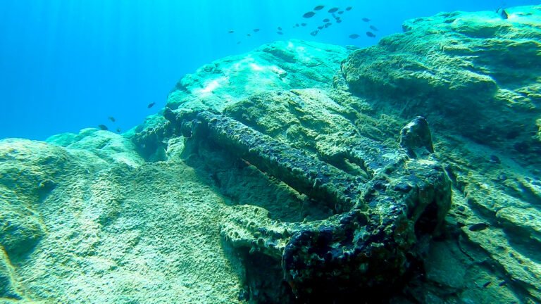
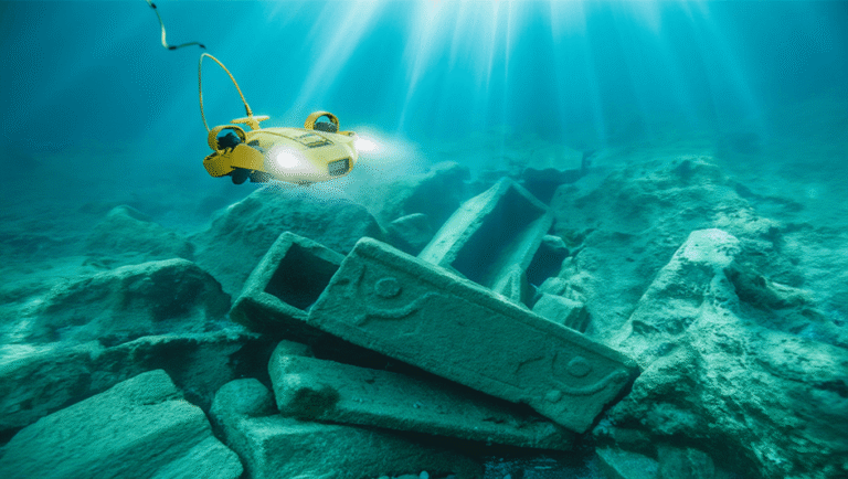
• Underwater reconnaissance
• Spatial mapping
Historical texts provide insight into naval activity and regional tensions, while field research and digital documentation allow reconstruction of how geography influenced maritime behaviour.
Through integrated research approaches, Sapientza becomes more than an isolated island — it becomes part of a maritime landscape shaped by exchange, defence, and risk.
A Regional System
When considered alongside:
• Methoni – Coastal Fortress
• Koroni – Gulf Overlook
• Paleokastro – Elevated Watchpoint
Sapientza contributes to a broader understanding of how southwestern Messenia functioned as an interconnected defensive and commercial environment.
The island’s significance lies not in monumental architecture alone, but in its role within a dynamic system of movement and observation.
Further research, including coastal survey and underwater documentation, aims to clarify this relationship between land, sea, and historical activity.